


Geopolitical Report Data
Geopolitical Report Data provides you with event summaries, terrorist or insurgent groups involved, casualty data, geographic coordinates, sources, and more.
We Collect OSINT and Map It
We do all of the open source intelligence (OSINT) collection of events each month, quantify impacts with casualty data, and map their locations, so you don't have to. Helping you better understand geopolitical risks and saving you time and money.
Get Started With Data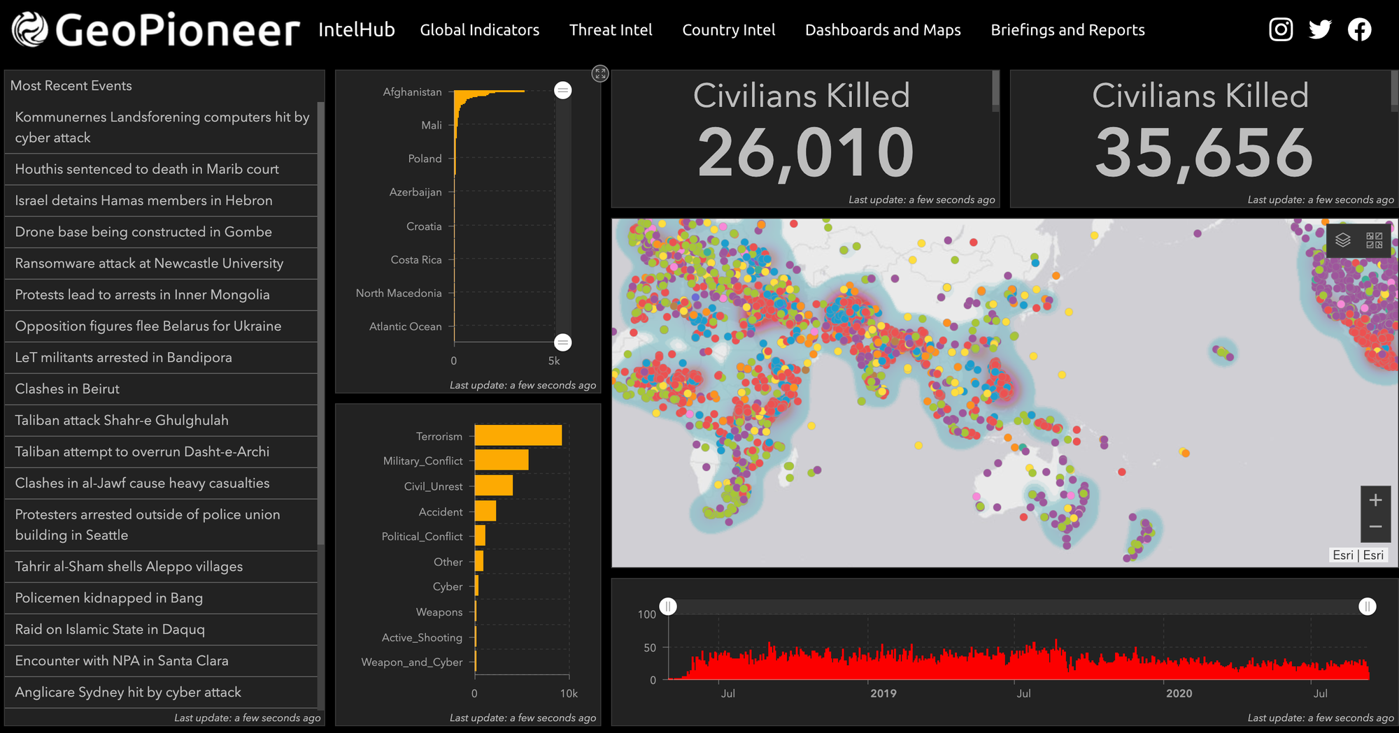
Daily Collection
Geopolitical Report Data provides summaries from an average of 50 new geopolitical events daily. The coverage is worldwide and tracks over 85 types of events, and over 100 terrorist/insurgent organizations.
Get Started With Data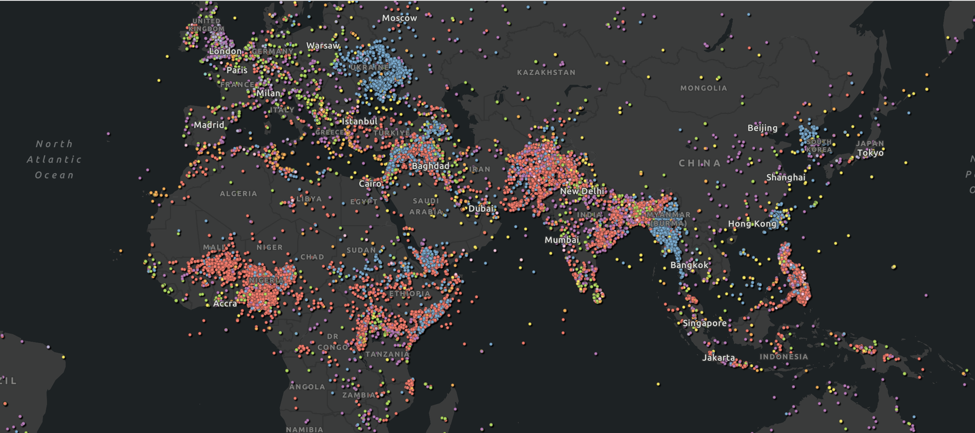
Access to over 70,000 event points
Access to the complete archive of over 70,000 geopolitical reports since January 1, 2019, with locations and data. Available by the month or year.
Get Started With Data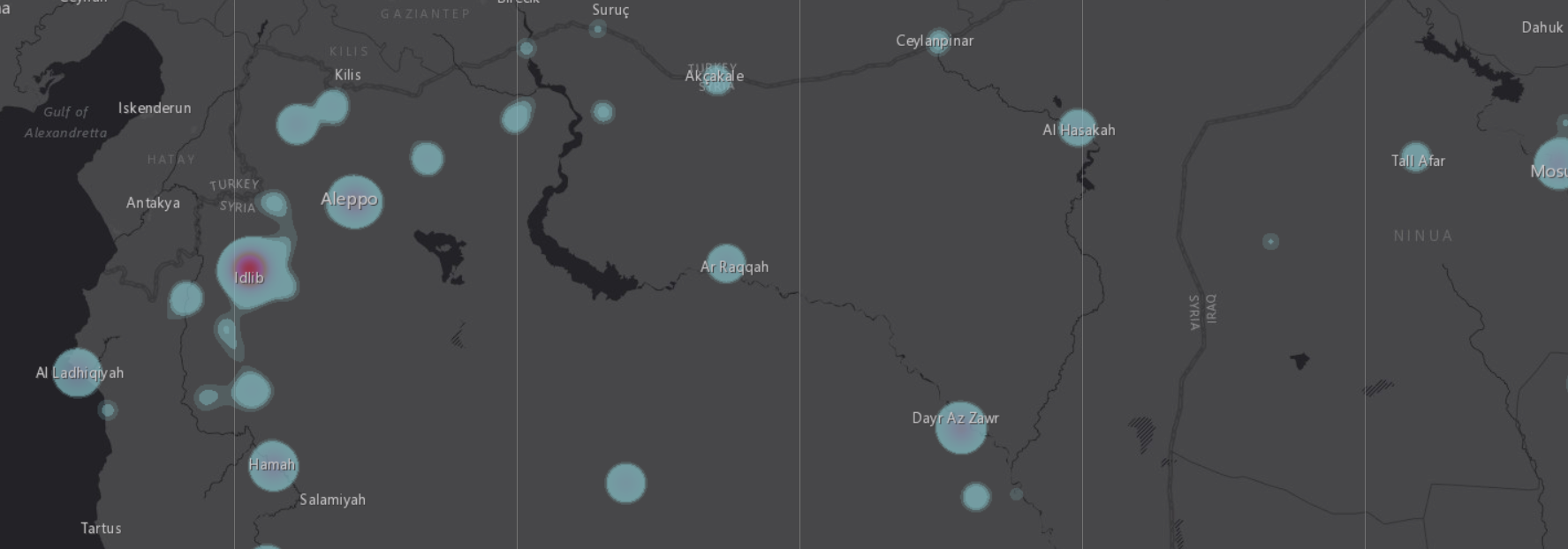
Available for Download or via API
Geopolitical Report Data can be downloaded in CSV, KML, or Shapefile formats. Additionally, it can be used or sold in your internal and external software applications via ArcGIS REST API, GeoRSS, or ArcGIS Online Feature Layers.
Get Started With DataGet Started With Geopolitical Report Data
Gain access to over 70,000 geopolitical reports and geospatial data for use in your own software, such as ArcGIS, QGIS, or Tableau.
Get Started With Data